Tornadoes possible with Monday night storm
Weather officials say tornadoes are possible as severe storms track through south-central Nebraska on Monday night.
July 1, 2024Updated: July 1, 2024 By News Channel Nebraska
By News Channel Nebraska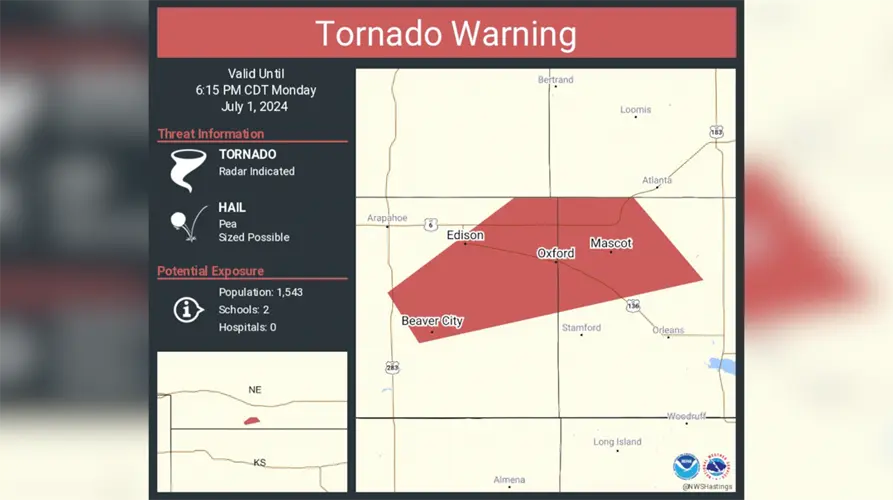

Weather officials say tornadoes are possible as severe storms track through south-central Nebraska on Monday night.
By News Channel NebraskaHastings Businesses Rallying Around Highway 6 Construction
Hastings Golfers Come Together to Raise Funds for Cancer Patients
Cancer survivors take the spotlight during inaugural Grace on the Runway fundraiser in Kearney
CCC Approves $14 Million Residence Hall for Grand Island Campus
Central City welding camp doubles in size as more students explore skilled trades
Man Dies Following Alleged Assault in Grand Island